
March 17, 2020 | Posted by misfitwanders | Adventure, Hiking, Lifestyles, Nature, Sweden, Traveling
A breeze picks up and brings more life to the open grassy area. One side is covered in towering mountains and the other side has lush forests that sway with the breeze. Hiking trails in Sweden nature is welcoming to hikers as long as they respect as they wander. If you decide to travel North in Sweden, then you’ll see mostly wilderness. National Parks and Nature Reserves are a tenth of the country’s land. So, you can say that the swedes have a lot of nature and tend to care for it. Thus, making it extremely important for a hiker to be responsible for their belongings while venturing through the outdoors.
Check out the do’s and don’t while hiking in Sweden!

Table of Contents
Difficulty: Moderate- Difficult – Distance: 440 km- Duration: Approx. 10-12 Days – Coordinates: N68.286147°, E18.591137° – Address: ABISKO TURISTSTATION 2, 981 07 Abisko – Transport: Train or Rent a car
Eyes are left wide open in amazement as the high mountains cover the horizon. This trail has sections that are for all kind of hikers. This is the most famous and longest trail within Sweden. The most popular start is at the STF Abisko Turiststation. Take in the beauty of Abisko National Park as you start hiking trails in Sweden through this area. This trail lies above the Arctic circle and has well maintained trails. There are mountain huts that you can use as you hike the trail. STF has 16 mountain huts that are sprawled through the trail and are about 10-20 km from one another. Nights get cold, so have the right gear with you.
You can either take a train or rent a car to get to the popular starting point from Stockholm. If you’re planning on taking a train, it will be about 17 hours before you get there and you get on at Stockholm Central station. Or if you drive, it will take you around the same time, just that you would be on your time and not a schedule.
Check out google maps to see the driving or train information.

Helpful links:
www.svenskaturistforeningen.se
Maps:
www.distantnorth.com
Difficulty: Easy-Difficult – Distance: 1,000 km (broken into 2-22km) – Duration: Approx. 30 min.-20 days Coordinates: 59°11′N 18°18′E, 59°11′N 18°18′E – Address: Svartbäckens by 361, 136 59 Vendelsö – transport: Train, Bus, or Rent a car
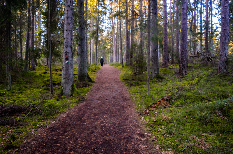
This is a cluster of trails that are in 100 sections. It’s one of the longest hiking trails in Sweden. The main trail is 627 km long. In the mix, are circular routes and bonus routes in more popular areas. Some of the trails can last an hour to a couple of days. It’s marked with orange on the paths. It’s usually an orange circle on a pole or tree. As you wander on this trail, you will see the beautiful lakes and forests that cover much of Sweden. There’s a starting point in Tyresta National Park for Sormlandsleden, which is near Stockholm.
Learn more about Tyresta National Park here and start Sormlandsleden from there!

You can drive or take the subway and switch to a bus. Driving takes about 30 minutes to get there, while public transportation takes around an hour. For public transportation, start at Stockholm Central and go into the subway and ride number 17 to Gullmarsplan. Get off there and switch to bus 807 that’s going to Svartbäckens. It´s only 350 m away from there.
Check out google maps for directions on driving.

Learn more about this trail here:
Map:
Difficulty: Strenuous – Distance: 38 km- Duration: Approx. a Day- Coordinates: 67.8509° N, 19.0150° E (Nikkaluokta, starting point) – Address: 981 99 Kiruna – Transport: Train, Bus, or Rent a car
This is Sweden’s highest mountain. It lies in Swedish Lapland and has two peaks. The glacial southern peak was once the higher of the two but has been melting. So now, the ice-free northern peak is the highest. It´s 2,106 meters high and is in the Scandinavian mountain range. There are two climbing routes to choose from. The Eastern route is the harder one of the two paths. These hiking trails in Sweden are well worth a visit!
We ventured on the Western trail and it was filled with beauty! Check out my article to learn what’s best to know before hiking Kebnekaise. From Nikkaluokta, you have to hike to Fjällstation before you can start your journey up Kebnekaise. You can learn in more detail about this hike here.

You can take public transportation or drive to Nikkaluokta to begin hiking. From Stockholm Central station with driving, it will take about 15 hours. If you take public trans., you´ll be there in about 18 hours. For public transportation, start at Stockholm Central station and get on SJ Regionaltåg train. Then, once you´re in Kiruna, you switch to a bus that takes you to Nikkaluokta. With driving, you take the E20 and switch to E4 and E10 to Kiruna.
Learn more at google maps.

Helpful link:
Map:
Difficulty: Easy-Difficult – Distance: 105-110 km Round trip- Duration: Approx. 2 Days – Coordinates: 56.6690° N, 15.3341° E – Address: Grimsnäs Herrgård, 365 94 Skruv – Transport: Train, Bus, or Rent a car
South East of Sweden has nature right at its doorstep. Listen to the birds sing as you wander through the dense forests and near clear lakes. Take in the scenic meadows with forests and wander near stonewalls. This, like one of many hiking trails in Sweden is marked with orange. There are signs that say Vandringsled on the path as well. About every 15-20 km there´s a place you can stay overnight. There´s a cycling path that´s also offered. They have a package deal for hikers, or you can go on it alone.
Driving will take you about 5 hours compared to public transportation that´s 13 hours. For public trans., start at Stockholm Central station and get on SJSnabbtåg X2000. Get off on Alvesta station and get onto Öresundståg train. Stay on there until Lessebo station and switch to bus 219 to Grimsnäs. Then, you´re 600 meters away from Grimsnäs Herrgård. If you´re driving, start in Stockholm and get on Route 72. Then get on E4 to Route 32. Destination is in Kronobergs län.
Check out google maps for info.

Helpful link:
Maps:
Difficulty: Moderate- Difficult – Distance: 1,250 km- Duration: Approx. 100 Days – Coordinates: 56° 18′ 8.136” N 13° 34′ 41.484” E – Address: Hårsjö 1205, 280 22 Vittsjö – Transport: Fly or Rent a car
There are 6 sub trails and over 100 sections in this long trail. The path is marked with orange and some of the trails loop, which makes it easy to do in a day. Walk through lush forests and near crystal clear lakes with this long trail. Or wander on section or two of it. One of the hidden places to see on the trail is Boafall-Olofström. Hiking trails in Sweden always leaves you with a stress-free feel as you hike the nature.
The best way to get to these trails is to rent a car or fly to the southern part of Sweden. If you’re in Stockholm, the drive will take about 5 hours and 30 minutes. Take E4 to Skåne county.
Check out google maps for more directions.

Helpful link:
Map:
Swedish Tourist Association- Skaneleden
Difficulty: Moderate+ Difficult – Distance: 130 km- Duration: Approx. 5-7 Days – Coordinates: 63°00’33.5″N 18°11’14.3″E – Address: Myntgränd 34-30, 870 32 Ullånger – Transport: Bus or Rent a car
Hear the birds chirping away as they soar from branch to branch in the dense forests. Or enjoy the sandy beaches with a nice breeze from the lakes. There are 13 different sections on this long trail that makes it more hiking trails in Sweden. It will give you a variation of nature while you hike up and down the terrain. Since it´s called the high coast trail, it usually is following the coastline. You can just do a part of the trail or do a couple of the trails. Starting points vary, but I have one up on the coordinates and address, so you can make it to section 6.
Bus times: https://www.dintur.se/
You can take public transportation, which can take 6½ hours to 9 hours depending on the way you choose. Stockholm central station is where you would begin. The easiest option is take the Y bus that goes straight to Ullånger busstation. It´s also the quickest public transport there. Or you can drive and be there in 5½ hours. Just take E4 to Ullånger.
For more information on getting there, check out google maps.

Helpful link:
Map:
Swedish Tourist Association- High Coast Trail
Difficulty: Easy-Moderate- Difficult – Distance: 70 km- Duration: Approx. 5 Days – Coordinates: 56° 17′ 47.976” N 12° 29′ 9.132” E – Address: Kullaberg, 263 77 Mölle – Transport: Rent a car
Spend time in a nature reserve packed full of new adventures. There´s an easy trail and a demanding trail on this peninsula. Hike near the water and enjoy all the pleasant views as you wander these hiking trails in Sweden. The path is marked with orange and makes it easy to turn your trip back again with some loops.
There is no public transportation to get to Kulleberg Nature Reserve. So the only way is to rent a car. Driving from Stockholm will get you there in about 6 hours. Use E45 and E 20 to Kulleberg.
Check out google maps for more.
Helpful link:
Map:
Difficulty: Moderate- Difficult – Distance: 47 km- Duration: Approx. 3-4 Days – Coordinates: 63.1711° N, 12.3465° E- Address: 831 41 STORULVÅN, Björkbackavägen 14, 831 43 Östersund- Transport: Fly or Rent a car
This trail is nicely marked and can be done within 3-4 days. This is one of the most popular trails in Sweden since it has beautiful mountains and lakes. Wander up a mountain and enjoy the amazing views! Don’t forget respect for the locals’ land.
The way to get here is by flying or by renting a car if you’re coming from Stockholm. Driving would take around 8-9 hours. Take E4 for the fastest route. The closest place that you can fly to is Östersund, if you plan on flying near. Then, you can take a bus or train to this trail.
Check out google maps for more info. on directions.

Helpful links:
http://www.jamtlandstriangeln.se/ (Only in Swedish)
https://www.swedishtouristassociation.com/trails/the-jamtland-triangle/
Map:
www.swedishtouristassociation.com
Difficulty: Easy-Moderate- Distance: 150 km- Duration: Approx. 5-6 Days – Coordinates: 67.7226° N, 17.4684° E (Ritsem) – Address: Ritsem 4, 98299 Gällivare – Transport: Train, Bus, or Rent a car
There are 13 cabins on this trail that are about 15 km apart. Even though this is a long trek, the path is relatively nice to walk. Plus, the views make it worth each step. Take in a variety of nature as you put one foot in front of the other. Each day will bring you to new sights. See mountains, lakes, and beautiful flowers if you hike in the spring or summer.
From Stockholm, it would take about 15 hours of driving to get there. You can take public transportation to it and you would arrive there in about 18-19 hours. If you want to take public trans., first you need to get on SJ Regionaltåg at Stockholm centralstation. Stay on there until you reach Gällivare C/Resecentrum. Then get on bus 93 and it takes you to Ritsem Fjällstation. You´re about 200 meters from STF Ritsem (starting point). With driving, check out google maps to see the directions to it.
Driving Directions from Google maps

Helpful link:
Map:
Difficulty: Moderate- Difficult – Distance: 400 km- Duration: Approx. 7-9 Days – Coordinates: 59° 46′ 25.356” N 17° 38′ 43.044” E – Address: Kungshamn, 755 98 Uppsala – Transport: Train, Bus, or Rent a car
There are sections of this trail that has loops, which makes it easier getting back to where you started. The trails are marked with orange on trees. Here the sounds of the birds chirping away as you wander through the forests. On the long hike, there are places where you can have fires and grill. If you don´t have time for the whole trail, there are several trails within the long trail.
You have two options; you can drive at the starting point, or take a train and switch to a bus to get there. Driving yourself will take about an hour and taking public trans. will take about an hour and a half. If you’re planning on taking public trans. then take the train Pendeltåg 40. Once you make it to Knivsta Station, hop off and switch to bus 101. It will take you to Kungshamn and from there, it´s a 180 meter walk to the beginning of the trail.
If you plan on driving, take E4 to Route 263. Take exit 180- Trafikplats Märsta and drive to Route 255 in Uppsala. For more information on driving directions, check out google maps.

Helpful links:
upplandsstiftelsen (About them)
Maps:
naturkartan.se (In Swedish)
Check out more hikes in Sweden here. Or find out more about the best gear for hiking! These are my recommendations from experience. Learn more about the gear here!


