
January 1, 2020 | Posted by misfitwanders | Adventures, Hiking, Nature, Sweden, Travel, Traveling, Trekking
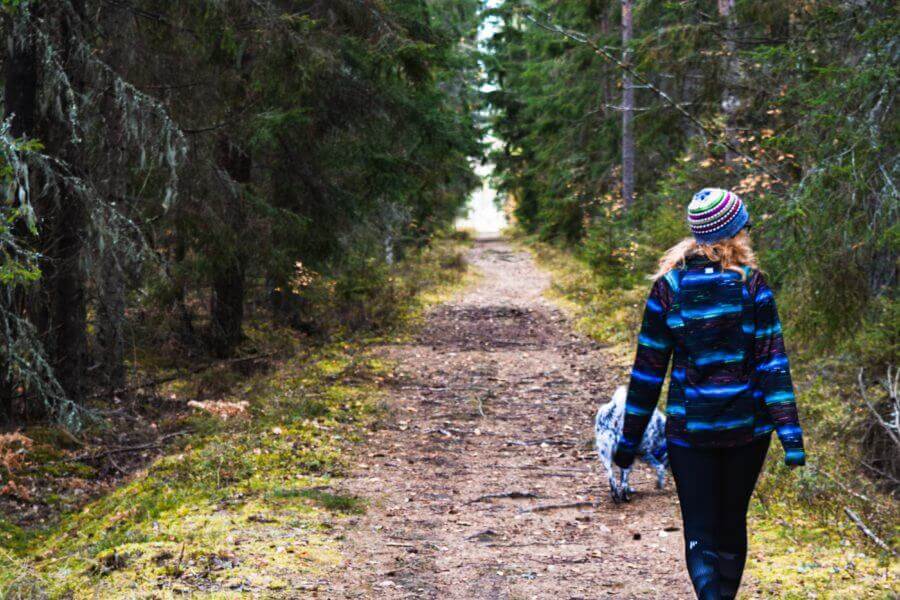
The sun radiated the land with a glow. Hiking Varmland left me feeling warm all the way down to my toes. Many people passed by with smiles and the flowers surrounding us were in bloom. This area engulfed us in the nature’s beauty. That’s when I realized I had fallen in love with hiking Varmland, my hubby’s homeland in Sweden. This was the beginning of our years living in Sweden. Now, it’s going on 3 years of being consumed by forests and in walking distance to a couple of lakes. All my stress leaves me once I begin walking through the forests. Since I have a dog, we have several walks a day through our backyard forest. It’s such a great way to leave stress behind and enjoy life with the fresh air and the sound of chirping birds.
Table of Contents
Hiking Varmland can vary. If you want to have an easy walk, there are loads of those spread out in the area that can last to an hour or up to a whole day. If you want to challenge yourself, there are trails that can last for days and others that can be pretty steep. The animals that are in the area range from deer, moose, elk, wild boar to wolverines, lynx, wolves, and bears. The predatory animals will rarely bother humans. But it’s pretty common to see deer and moose. Check out Vandringsleder.se for more information.
Sweden is known for its weather changing pretty quickly, so be prepared for it. If you’re wanting to start hiking Varmland, It’s always best to check out the weather before you start heading out and bring a compass or a gps device with you. Check out this here to learn more about Swedish weather.
Difficulty: Easy-Moderate- Distance: 1 km- 3.3 km- Duration: Approx. 30 min.-2 hours- Coordinates: 59.9000° N, 12.9500° E, (Outside of Sunne)- Transport: Rent a car to get to it

The trail goes 200 meters up high from the parking area. The map above is in Swedish, so I will translate so you can understand and be able to use the map.
Translation for Map:
There are several different paths as you can see on the map. It really depends on where you want to start your journey from and how long you want it to be. It can be 1 km to 3.3 km long, and it’s best to rent a vehicle to get there and back. You can rent a vehicle if you click here. The terrain isn’t too difficult and the trails are marked. Once you get to the top, there’s a beautiful view where you get to look over the area. The trails don’t loop and it’s best to have a day pack with you and a water bottle.
My go to daypack has always been Osprey. Since I began my traveling adventures in 2012, I’ve used an Osprey. They’re built to be durable and many of them include a waterproof cover, which is really helpful. The only downside I found is that the 24L size one that I have doesn’t have a clip on the spot where I put my water bottle. So I’ve gone through several water bottles with mine falling out as I toss it around when I’m traveling. Whoops!

Check out the daypack here!
It took us about 30 min to 45 minutes to get up the 1 km steep hike. I felt like I was huffing and puffing for dear life! This was a practice hike for us before we ventured to Norway for our hiking trip. My body was out of practice, but once we made it to the top, the view reminded me why I enjoy hiking. The breeze helped cool me down and just as soon as my body felt overused, it went away. Seeing that view, I felt alive!
Difficulty: Easy- Distance: 12.9 Km- Duration: Approx. 3.5 hours – Coordinates: 59.4809° N, 13.3960° E (Outside of Kil) – Transport: Rent a car to get here
This area while hiking Varmland, is relatively easy and there are parts where you walk through pastures. Be wary, a part of the hike you walk through high grass, so it’s best to have long pants on since they usually have stinging nettles! As you follow this path, you’ll get to walk alongside the river Klarälven. Spring time here is filled with blooming flowers and luscious green grass. All the markings on the path are orange, so they stick out. This trail loops around and stays fairly easy the whole way.

Check out Walking in Värmland. It’s a great guide book for hikes in Värmland in detail and it’s in English. That’s always a plus! It has 22 routes and helpful maps in it. The photo above is from the book. This is what we have used for some of our hikes in this area. It has been a great help!

Our journey on this trail became a hectic mess. First off, we decided to go on this adventure on a day where the snow was melting… So we ended up enduring several puddles on the paths. It took away from the trail. But, we plan on trying it again in springtime. It will be a great time to see all the flowers and life in this beautiful spot!
Difficulty: Easy- Distance: 7 Km- Duration: Approx. 2.5 hours – pic. Of trail- Coordinates: 59° 48.554 N, 13° 34.244 E (In Munkors) – Transport: Rent a car to get here

This trail is well marked and is a great place for a picnic or a swim when the weather allows it. The path loops around and is easy to walk. The green/white marked path will lead you to a jetty and go through Swedish forests. There are parts of the trail where you’ll get to see the makeshift paths swedes made so hikers can take the paths easily.

In Sweden, it’s hard NOT to see any of their traditional red houses. On this trail, you get to see one of their red houses. They began using this paint to help preserve the wooden cottages. It originally came from copper mines in Dalarna. This began as early as the 16th century and now, has become more of a tradition. Don’t forget to grab a good water bottle for hiking Varmland! No matter where you hike, it’s always good to go prepared. If you feel unsure about the trail, take a gps with you and bring a friend. Something that I’ve found is a helpful thing to have is a bandana. It can help you on cold days or it can help stop your hair from getting in your face. So versatile!
Difficulty: Difficult – Distance: 6.8 Km- Duration: Approx. 4 hours – Coordinates: N 60° 17.624 E 13° 28.092 (North of Ekshärad)- Transport: Rent a car to get here
If you want to see a waterfall, this is the trail for you. The water splashes down on red rocks which give it a unique look. This trail opens May 15th, and it resides in Hagfors. The path is well marked and to see the waterfall at its best, go in the spring or winter time. You can download the map here for the trail. Hiking Varmland can have any hike that you want. It’s just you need to know where to find them.
Since this trail is harder than the others, don’t forget to have durable boots on. I highly recommend waterproof Salomon boots. Mine have lasted for years and recently, I’ve been having problems with them being waterproof. But they survived longer than I had expected. It was actually my hubby that made me realize how important your shoes are when it comes to hiking out in nature! Never again will I use crappy $20 shoes. I tried that once, I walked them to their death! It was so hot and the trail I was on lasted around a whole day. My shoes melted! The next day, I had to walk out of that canyon with melted bottoms on my shoes, what a hike!

If you have any questions or need help, you can reach Hagfors community.
Hagfors-Ekshärad tourist information: turist@hagfors.se
Telephone: +46 (0)563 187 50
Check out Hiking in Sweden if you want to learn more about the country and the things that are offered in nature. There are great places where you can hunt for berries or mushrooms. Sweden even has a law, where people have a right to roam nature. You can learn more about these things in the article Hiking in Sweden.
If you like hiking in Värmland, then check out Hovfjället Nature Reserve. It’s a beautiful place with some great hiking trails near Torsby! You can learn more here. This is a place you can enjoy in all seasons since it has Hovfjället Ski Resort in this area. Here, you can ski, ride snowmobiles, and other activities. Check out more about Hovfjället.
Helpful guide (in Swedish):
I can get a commission if anything is purchased from several of these links.
Don’t worry, this doesn’t effect the price. It turns into helping you and helping me!


