
February 10, 2020 | Posted by misfitwanders | Adventure, Hiking, Lifestyles, Nature, Sweden, Traveling, Trekking
The trails are bustling with life once I make it to some of the best trails in Karlstad. The atmosphere engulfs me with happiness as people hike the paths. Nature is at the cusp of the city and several parks are within the area. Living as ‘the Swedes’ they are, nature is a necessity to stay happy. Since they have rent a bikes that you can use, it makes it a lot easier to get around the city. Or you can enjoy their transit system through the mellow roads!
Karlstad is the capital of the Värmland county, which is known as the nature county. So, of course this area will have tons of great trails in it. I have ventured through many of the streets and trails since living in Värmland for 3 years, and being just an hour train ride away from Karlstad. The river Klarälven runs through the city. With that, you can take a ferry or a boat through the city. While you walk in this area, you may notice they have sun faces sprawled out on their library or their community house. That’s because this tiny city is known as one of the sunniest towns in Sweden. Come and enjoy the sun’s rays while you hike here!
If you’re planning on venturing through Sweden or you’re going to be enjoying the outdoors, check out Hiking in Sweden. This article will tell you more about Swedes and their way of doing it when it comes to nature.
Table of Contents
Difficulty: Easy – Distance: 1 km- 3.3 km- Duration: Approx. 30 min.-2 hours- Coordinates: 59.3699° N, 13.4871° E- Address: Treffenbergsvägen, 652 29, Karlstad – Transport: Bus, walk, or Rent a car

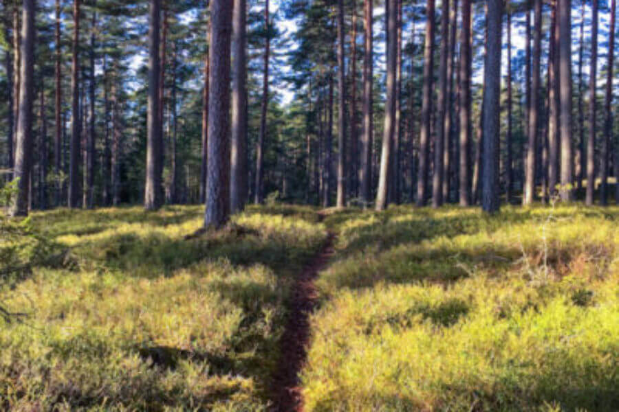
Once I crept closer to my destination, Mariebergsskogen, I could see the beauty of the river next to it. With the sun shining down, the day felt right for a hike in Karlstad’s city park. There are several things you can do here and it’s for all ages. What better place to venture with the family than here? If you don’t care so much for all the people, start a journey through the trails on the outskirts of the park. It feels as though you’re not even in a city as you wander the paths. That’s why this is one of the best trails in Karlstad! Many of the trails connect, so it makes it easy to take on several of the pathways.
Take bus 12 from Karlstad Central (train station) and it brings you right to Mariebergsskogen. Nice and easy!
Difficulty: Average – Distance: 1.8 km- 3 km- Duration: Approx. 1 hour -2 hours- Coordinates: 59.3909° N, 13.4819° E- Address: Säterivägen 8, 653 41 Karlstad – Transport: Bus, walk or Rent a car

We start our hiking through this area and glimmering in the distance I could see something. As I neared, I could see that it was a sign written in Swedish. It was a game for children who walked these trails to keep it entertaining for them. These trails were marked well and easy to see. They have places where people can have a picnic and start grilling up some food. This area also has specific paths for jogging.
Watch out, on certain Saturdays of the year, they use a shooting range that’s inside this place and they let hunting happen as well. But those are only on the Saturdays a couple times of the year. Take a nice relaxing stop at the resting spots as you hike one of the best hikes in Karlstad. If you’re at Karlstad C, you can either walk here, which is around 2 km, or you can take a bus. Renting a car helps you get to the harder places to reach that you can’t with just the transit and your hiking boots.
You can take bus 6 from Karlstad C, which brings you to Tingvalla isstadion. You just have 290 meters left to the park. Or you can drive from Karlstad Centeral.

Difficulty: Easy- Difficult – Distance: 800 m- 22km- Duration: Approx. 15 min – 15 hours – Coordinates: 59.3744° N, 13.3875° E- Address: Skutbergsvägen 159, 653 46, Karlstad – Transport: Bus or Rent a car

The sun peaked out on a winter day while I visited Karlstad. My smile widened. It’s a good day for a hike. My best buddy (my dog, Clyde) and I took my car and out we went towards Skutberget. There’s a nice path that follows near the lake. At the beginning, you will get to enjoy a HUGE beach (not really, it’s actually small). The view of lake Vänern at that spot is definitely worth wandering to.
As I began hiking the trail, I noticed with Alltrails App, there are loads of trails in this area. So we ended up doing some of the connecting paths. Since all the trails connected, it made it easy to hike back to where we had started. As we hiked, many joggers passed us and a few bikers. There’s a 8.5 km bike trail and a trail for jogging. But you can hike on any of these best trails in Karlstad.

The sun warmed me to my bones, it was a good day! We followed next to the river at the beginning. The ground was nothing but stone! It was amazing and still, there were trees and random bushes growing off it. The vegetation there is beautiful and so welcoming! They have places to camp, play disc golf, resting benches on some of the trails, and grilling spots. They even have a restroom! Yeah I said it, a restroom!
Learn more at Karlstad’s website!
To get there, you can take bus 1 and it will take you right there! The ride is about 30 minutes.
Difficulty: Easy- Moderate – Distance: 1km- 10km – Duration: Approx. 15min.- 6 hours- Coordinates: 59.3485129 N, 13.5210465 E- Address: 663 41 Hammarö, Karlstad – Transport: Bus, walk, or Rent a car

This area actually has a few different trails. One is the more known, Pilgrimsleden (the Pilgrim trail). Here, the trail is 1 km. Another one offered in this area is called mörmospåret. This is one is around 2.5km and has markings on the bark of the trees. There are even more trails in Kilenegården. They vary 1km to 10km, check it out! They’re nice to see and definitely are some of the best trails in Karlstad.
As you hike this area, it’s best to have good hiking boots. It took me a bad pair of shoes on a hike to realize how important GOOD shoes are! Going on 2 years now, I’ve been using these great Oboz hiking boots. Check them out!
Difficulty: Moderate – Distance: 5.7 km- Duration: Approx. 2 hours- Coordinates: N59° 15.683, E13° 5.592- Address: Unnamed Road, 660 40 Segmon- Transport: Rent a car

Kycklingleden means, the Chicken trail. With this trail, you follow near lake Vänern and hike up a mountain for a beautiful view of Western Europe’s biggest lake. On this trail, there are ups and downs, which can make it a little strenuous for some. It even has places where ropes are used for the steep areas. It’s a loop trail that’s in the Grums community, which is next to Karlstad city, making this area filled with some of the best trails in Karlstad. The only way here is to rent a car.
If you want to know more about the trail, check out: https://varmlandsleder.se/en/vandringsleder/kycklingleden/
Take highway E18/E45 to Grums. Take the exit Liljedal. Stay on the road for 4.5 km. Cross a bridge, then take the first road to the left, Budavägen. Follow this road for 1km, when the road forks, keep to the left. At Buda Farm, keep to the right. You made it!
Difficulty: Moderate – Distance: 3-17 km- Duration: Approx. 1-8 hours- Coordinates: 59.3667° N, 13.6333° E – Address: 656 71 Skattkärr – Transport: Ferry, Bus, bicycle, or Rent a car

This place is a welcoming island that’s also a nature reserve. Here, there’s 3 different trails short to long. They have shelters and restrooms for visitors. Plus, as you hike, there are great stopping points making this one of the best trails in Karlstad. Bring food with you and have a picnic in the sun. You can get here by taking a boat, ferry, or a bus. You can either rent a bicycle or a car and ride on the ferry with it.
From Karlstad bus station, you can take 501 bus that runs daily to get to it.
If you need more info check out these:
https://karlstad.se/Jamfor/enhet/?unit=bb0b96f781604a81bf478db77ee2f397#
https://karlstad.se/Trafik-och-infrastruktur/Kommunikationer/Bat/Farja-till-och-fran-Javeron/
https://www.visitvarmland.se/en/do/vildmarksleden-wilderness-trail-27128
https://www.klaralvsbanan.se/en
https://www.visitkarlstad.se/en/do/activities?sid=e27391676334
To find out more about hiking in Sweden press the button!

Or to find out about more Hiking blogs out there, check out Top 100 Hiking Blogs.
Any products I recommend, I make a commission.
This doesn’t change the price, so you’re paying the same.


